
Dhul-gariir xooggan oo cabbirkiisu ahaa 6.0 Magnitude ayaa saqdii dhexe ee xalay ka dhacay Gacanka Cadmeed, qiyaastii 145 KM waqooyi ka xigta degmada Caluula ee gobolka Bari. Ilaa hadda ma jiraan khasaare naf ama hanti oo la soo sheegay.
Waqtiga iyo Xuddunta Dhul-gariirka
Sida xogta Hay'adda Sahanka Juqraafiyeedka Mareykanka (USGS) ay sheegtay dhul-gariirku wuxuu dhacay 12:07 habeenimo ee 28-ka Agoosto, waqtiga Soomaaliya, waxaana xudduntiisu ku taallay badda hoosteeda, iyadoo qoto-dheeraanta lagu qiyaasay ku dhowaad 10 KM.
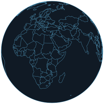
Xuddunta gariirku waxay ku taallay meel badda ah oo ka fog goobaha dadku ku badan yihiin, taas oo yaraynaysa khatarta loo maydhan yahay dadka iyo dhismayaasha. Meesha uu ka dhacay waxay qayb ka tahay Gacanka Cadmeed ee waqooyiga Soomaaliya.
Saamaynta Laga Dareemay
Warbixinno la helayo ayaa sheegaya in gariirka laga dareemay qaybo ka mid ah Soomaaliya iyo Yemen. Tani waxay muujinaysaa baaxadda uu gariirku gaaray xitaa iyadoo xudduntu ay badda ku jirto.
USGS-na waxay diiwaangelisay heer gariir oo gaaraya (4) marka loo eego cabbirka Mercalli, taas oo keeni karta in dadka gudaha dhismayaasha ku jira ay si cad u dareemaan gariirka, isla markaana ay ruxmaan albaabada, daaqadaha iyo walxaha qaarkood.
Dhaqdhaqaaq Dhulka oo Horay loo Arkay
Dhul-gariirkan ayaa ah dhacdo muhiim ah marka loo eego dhaqdhaqaaqa dhulka ee gobolka, iyadoo 25-kii Juun 2026 uu isla aagga Caluula ka dhacay dhul-gariir kale oo cabbirkiisu ahaa 5.1 Magnitude, kaas oo sidoo kale ku dhacay qiyaastii 10 KM badda hoosteeda.
Kala duwanaanshaha u dhexeeya 6.0 iyo 5.1 Magnitude ayaa muujinaya in aaggu uu marar kala geddisan gariiryo uu la kulmo. Ilaa hadda lama soo sheegin khasaare dhimasho, dhaawac ama burbur dhisme oo ka dhashay dhul-gariirka.
A powerful 6.0-magnitude earthquake struck the Gulf of Aden on August 28, 2026, approximately 145 km north of Caluula in Somalia's Bari region, with its epicenter located about 10 km beneath the sea surface.
Seismic Event Details
The earthquake occurred at 12:07 PM Somali time on August 28, 2026, with its epicenter positioned in the sea at a depth of approximately 10 km. According to the United States Geological Survey (USGS), the Modified Mercalli Intensity was recorded at 4, indicating that people inside buildings felt the shaking clearly and some doors, windows, and objects rattled.
The tremor was felt in parts of Somalia and Yemen, reflecting the significant energy released by the event. The USGS data confirms the magnitude and depth, providing a clear picture of the seismic activity that took place in this region of the Gulf of Aden.
No Reported Casualties or Damage
As of now, no casualties, injuries, or building damage have been reported from the earthquake. The epicenter's location in the sea, far from densely populated areas, likely prevented significant harm to life or property on land.
Authorities and monitoring agencies continue to assess the situation, but the absence of reported damage suggests the event, while powerful, did not result in immediate humanitarian consequences for nearby communities.
Historical Context of Seismic Activity
This earthquake is a notable event in the region's seismic history, following another quake of magnitude 5.1 that struck the same area of Caluula on June 25, 2026, also at a depth of approximately 10 km beneath the sea.
The recurrence of significant seismic activity in the Gulf of Aden near Caluula underscores the ongoing tectonic movements in the area, prompting continued monitoring and awareness among local and international seismic agencies.
Ilaha iyo xuquuqda sawirka
Sawir: Goobjoog Xigasho