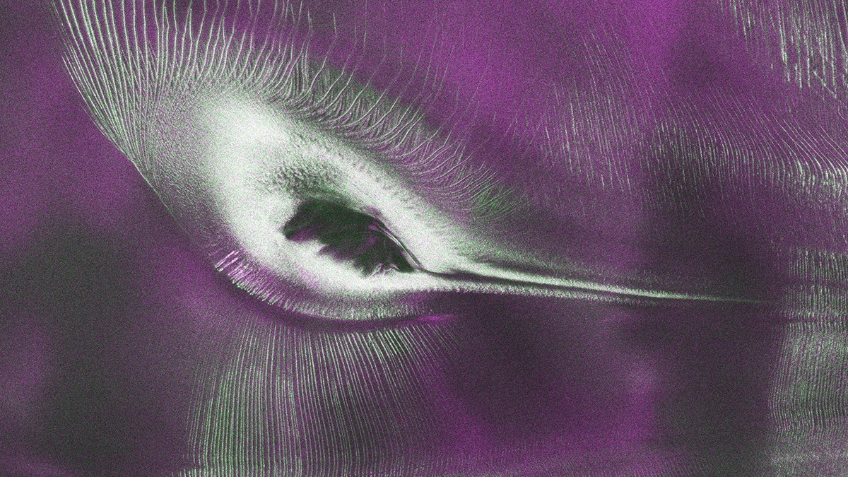
Satellite-ka NISAR-ka ayaa soo saaray sawir ku saabsan 'Ereyga Hummingbird' ee Antarctica
Sawirka iyo Maqnaanshaha
Sida ay sheegayaan warbixinnada NASA, satelaytka NISAR-ka ee dhex mara dhulka ayaa soo saaray sawir ku saabsan meel ka mid ah Antarctica, kaas oo loo yaqaan 'Hummingbird'.
Sawirka iyo Maqnaanshaha
Sida ay sheegayaan warbixinnada NASA, sawirkan ayaa la sameeyay bishii August 2025, kaas oo muujinaya meel ka mid ah Antarctica, oo loo yaqaan Nunatak Zaterjavshijsja, kaas oo ka mid ah dhulka sare ee dhulka.
Sawirkan ayaa loo yaqaan 'Hummingbird' oo ka mid ah ereyada loo isticmaalo, kaas oo muujinaya meelaha ka mid ah Antarctica, kaas oo ka mid ah dhulka sare ee dhulka.
Tixraaca iyo Tallaabooyinka
Sida ay sheegayaan warbixinnada NASA, satelaytka NISAR-ka ayaa ka mid ah dhulka sare ee dhulka, kaas oo ka mid ah dhulka sare ee dhulka.
Sawirkan ayaa loo yaqaan 'Hummingbird' oo ka mid ah ereyada loo isticmaalo, kaas oo muujinaya meelaha ka mid ah Antarctica, kaas oo ka mid ah dhulka sare ee dhulka.
Tallaabooyinka iyo Tixraaca
Sida ay sheegayaan warbixinnada NASA, satelaytka NISAR-ka ayaa ka mid ah dhulka sare ee dhulka, kaas oo ka mid ah dhulka sare ee dhulka.
Sawirkan ayaa loo yaqaan 'Hummingbird' oo ka mid ah ereyada loo isticmaalo, kaas oo muujinaya meelaha ka mid ah Antarctica, kaas oo ka mid ah dhulka sare ee dhulka.
A new radar image from the NISAR satellite reveals Nunatak Zaterjavshijsja, a mountaintop in East Antarctica, surrounded by deep crevasses in a flowing ice stream. Scientists have nicknamed the striking image 'the hummingbird.'
A Unique Dual-Wavelength Satellite
NISAR, which stands for NASA-ISRO Synthetic Aperture Radar, is the first satellite to carry two SAR instruments operating at different wavelengths. It orbits Earth and collects data using a giant drum-shaped antenna reflector measuring 39 feet (12 meters) wide, the largest radar antenna reflector NASA has ever sent into space.
NASA's Jet Propulsion Laboratory leads the United States component of the project and provided the satellite's L-band SAR and antenna reflector. The spacecraft bus and its S-band SAR were provided by the Indian Space Research Organisation (ISRO). The satellite is managed by Caltech.
How Polarized Radar Reveals Ice Structure
Over Antarctica, NISAR transmits radar waves toward Earth with a horizontal polarization. Signals that return with horizontal polarization likely bounced off a more regular surface, such as smooth ice, and appear magenta in the image. Signals that return with vertical polarization may have refracted as they partially penetrated the ice or scattered at different angles off irregular surfaces like crevasses.
Volume scattering observations are displayed in green in the image. White areas represent regions where both magenta and green signals scatter back strongly, indicating an equal blend of surface and volume scattering. The colors show differences in how polarized microwave signals interact with and reflect from the ice.
The 'Hummingbird' Image of Nunatak Zaterjavshijsja
The image of Nunatak Zaterjavshijsja was produced in August 2025. The obstruction causes stresses in the ice, heavily fracturing the surrounding surfaces with deep cracks called crevasses, which show as sharp green lines in the image. The ice stream flows northeast to the ocean.
The image has been nicknamed 'the hummingbird' by NISAR scientists. It captures a mountaintop poking out amid a stream of ice flowing northeast to the ocean, revealing how the obstruction shapes the ice around it.